Tag: fake maps

  • Fake Maps

    Fake Maps

    The communist regime used all possible means to silence its opponents. The passive ones, who, exasperated, were trying to leave and settle in the western free world, were also discouraged in every possible way: from being shot on the spot, to receiving life sentences and being manipulated and blackmailed. The communist border, symbolised by the Berlin wall, literally killed people, in cold blood. But besides the border as such, another means was used, subtler than physical violence: the fake map.

    In September 1964, at a consultative conference of the Socialist states, held in Moscow, a decision was made for those countries’ maps to be falsified, distorted and printed inaccurately. The regime thought that tricking those who wanted to flee by having them use fake maps, which would take them straight into the arms of the repressive apparatus, was preferable to physical liquidation. East Germany was in direst need of such maps. And taking care of that particular aspect was the job of the dreaded intelligence service, the Stasi. The Romanian political police, the Securitate, liked the method and took it over.

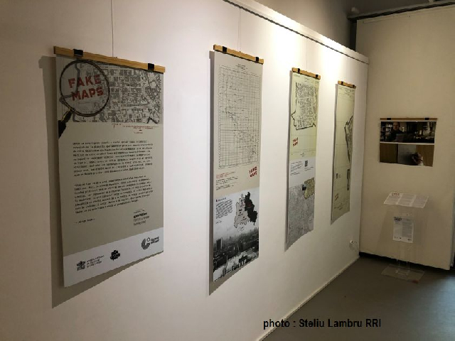
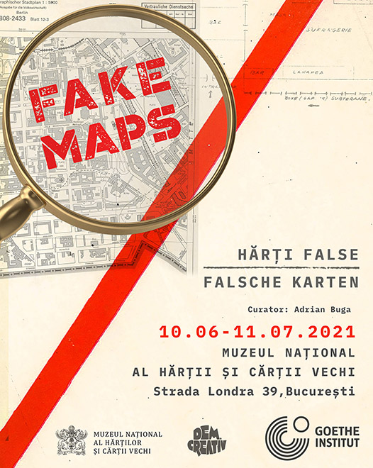
    The German Cultural Centre in Bucharest has organizedan exhibition titled Fake Maps, bringing together maps from the Stasi and Securitate archives. Facsimile of the fake maps used by the former German Democratic Republic and the former Socialist Republic of Romania were exhibited to show visitors one of the methods used by the communists to hinder any attempt at fleeing the country by those who could no longer endure the oppression of the regime.

    Curator Adrian Buga was the one that organized the exhibition. As he told us, a fake map drawn up before 1989 was aimed first and foremost at depriving people of the freedom of movement:

    I would put the sign of equality between a map and knowledge. Once you reach a new territory, whether we are talking about this planet or an extraterrestrial space, that knowledge can be used. And then, who has that knowledge, who has that plan, who has that map is also in control. At the same time, if you know how to control that information and you don’t want it to fall into the hands of your enemies, you falsify it. Another aspect of fake maps is that they are misleading when you want to escape from a space and need guidance. A map equals orientation, the information must come from a source that we consider credible. But in this case, that source we trust is falsified and used to our detriment.

    The fake map of the regime had to change the inner map of the individual. It falsified not only topography but also perceptions and beliefs about the outside world.

    Adrian Buga: From certain points of view we can say that the falsified map is specific to closed, totalitarian regimes. Once the regime controls and wants to oppress and pressure the citizens in a certain place, it must falsify the borders and it must falsify the way people perceive the place and other places from the outside. The information must be falsified to show how bad it is outside the matrix in which the regime wants to keep people and how good it is inside the matrix.

    What was the mechanism by which a map was faked? Adrian Buga says that the fake map was a deliberate alteration of an accurately drawn map.

    There were standard maps, topographic maps, providing information about cities, buildings, streets, about the type of soil, about rivers and so on. The standard maps were secret, no one had access to them except with certain approvals that were quite difficult to obtain. In the public space there were only tourist maps, on which certain places had been deleted or falsified. So, one would arrive at a place with the map in hand and discover that the place was completely different: either there were areas of uneven ground that did not appear on the map, or the rivers had been drawn differently in case a foreign army would want invade the territory, or just to make it difficult for the people who would try to escape and flee the country.

    The Romanian security did not draw up fake maps in the true sense of the word but resorted to something much simpler: interrogations of those captured.

    Adrian Buga explains: We do not have fake maps but the maps with the routes used by people to flee Romania. Those caught had to draw exactly the place where they had attempted to escape. The Securitate had to know the topography very well, mislead and discourage escape attempts. We are talking about the western border, the border with Hungary and the Yugoslav border on the Danube. There were many places there used by people to escape. There are many testimonies, and I am thinking of the book about the famous gymnast Nadia Comăneci and the Securitate. It is very interesting how Nadia describes that route and that guide, a shepherd of the place, who did not know the topography of the place.

    Researching the archives revealed, in addition to fake topographic maps, another type of map: the personal map of the individual and his private space. Tens of thousands of opponents were tracked with the help of sketch maps, which included everything, from domicile to the routine of every member of the family and visitors. (MI)

  • Les cartes trompeuses de la Roumanie communiste

    Les cartes trompeuses de la Roumanie communiste

    Le régime communiste avait tout mis en
    œuvre pour réduire au silence les opposants politiques. Quant à ceux qui voulaient
    malgré tout de fuir le paradis sur terre, ils risquaient de perdre leur liberté,
    si ce n’était pas leur vie, au moment où ils tentaient de franchir la frontière
    pour gagner le monde libre. La frontière du bloc communiste, symbolisée par le
    mur de Berlin, était le Rubicon que beaucoup rêvaient de pouvoir franchir à
    l’époque. Mais le régime communiste employait tous les moyens pour empêcher que
    cela se passe, depuis la propagande qui peignait en noir l’Occident, jusqu’aux
    balles que les transfuges risquaient de prendre lors de la tentative. Pourtant,
    une des méthodes moins connues que les régimes communistes de l’Est avaient
    décidé d’utiliser pour empêcher leurs citoyens de quitter le pays était la
    conception et la commercialisation des cartes trompeuses. Déjà au mois de
    septembre 1965, lors d’une conférence des Etats membres du bloc communiste,
    tenue à Moscou, il a été décidé que les cartes de ces pays contiennent des
    inexactitudes et de fausses informations. Ces erreurs volontaires avaient pour
    objectif de tromper les candidats transfuges, de les mener droit dans la gueule
    du loup, soit entre les mains de la police politique, plutôt que vers le pays
    voisin et le monde libre. La méthode était sans doute préférable aux yeux du
    régime à l’emploi des balles contre ceux qui tentaient de le fuir. Ce fut
    l’Allemagne de l’Est qui, la première, mit en œuvre la supercherie, grâce à la
    Stasi, sa police politique. Mais la Securitate roumaine n’a pas non plus trop
    tardé à mettre en pratique cette méthode.


    Le Centre culturel allemand de Bucarest
    a récemment inauguré l’expo intitulée « Fake Maps », basée sur des
    documents cartographiques de l’époque, récupérés dans les archives de la Stasi
    et de la Securitate. Des copies des cartes trompeuses, utilisées en RDA et dans
    la République socialiste de Roumanie font partie des œuvres exposées.


    Le commissaire
    de l’exposition, Adrian Buga, nous explique le rôle de ces cartes inexactes : « Pour
    moi, une carte est synonyme de connaissance. Parce que l’homme, dès qu’il
    découvre un nouveau territoire, que ce soit sur notre planète ou sur une autre,
    il va tout de suite vouloir le cartographier, l’étudier. Connaître c’est
    maîtriser pour mieux pouvoir utiliser. La connaissance est donc synonyme de
    pouvoir. Mais cette connaissance-là, on ne veut pas qu’elle tombe aux mains de
    l’ennemi, donc on va lui en fournir une mensongère. Les gens se fient en
    général aux cartes, on pense que l’information qu’elles nous livrent est
    fiable. On ne se doute pas que l’information puisse être fausse, à bon escient. »


    Falsifier une carte, c’est bouleverser les
    repères intérieurs de l’individu, lui faire perdre le nord, explique Adrian
    Buga : « Si l’on veut, on
    peut dire que la carte faussée soit la marque de fabrique des régimes
    totalitaires. Un tel régime doit falsifier la réalité, la vérité. Il doit
    falsifier la perception que les gens ont du monde extérieur. Il faut leur
    induire l’idée que tout ce qui est à l’extérieur du régime, du territoire
    contrôlé par le régime, est périlleux, est à éviter. Les gens doivent vouloir
    demeurer prisonniers, et pour cela il faut leur altérer la perception de la
    réalité. »


    Mais comment peut-on falsifier une
    carte, de façon pratique ? Comment s’en prend-on pour y parvenir, et pour
    livrer une information crédible de premier abord ? Adrian Buga répond :
    « Il y avait les cartes étalon, des cartes topographiques, censées
    fournir des informations détaillées concernant les localités, les bâtiments,
    les rues, les types de sol, la différence de niveau et ainsi de suite. Seulement,
    ces cartes étaient secrètes. Seules les cartes touristiques étaient publiques,
    et certains éléments présents sur ces cartes étaient faux. L’on pouvait arriver
    à un certain endroit, la carte à la main, et l’on saisissait qu’il y avait tout
    à fait autre chose sur place que ce qui y était représenté sur la carte. Il
    pouvait y avoir des différences de niveau, des cours d’eau qui n’étaient pas
    repris sur la carte, et ainsi de suite. Ces cartes étaient censées dérouter une
    armée ennemie, tout comme le futur candidat à l’asile politique en Occident, et
    qui tentait de franchir la frontière en douce. C’est eux que le régime voulait
    les voir échouer dans leurs tentatives respectives. »


    Pour ce faire, la Securitate s’était servie des récits des
    ceux qui avaient échoué dans leurs tentatives d’évasion du paradis communiste.
    Des récits obtenus à l’occasion des interrogatoires musclés. Adrian Buga, commissaire
    de l’exposition « Fake Maps », raconte: « Nous ne
    disposons pas à proprement parler de cartes trompeuses. Nous disposons en
    revanche de cartes que les auteurs des tentatives échouées étaient forcés de
    fournir aux agents de la Securitate. Ils devaient dessiner avec précision le
    trajet qu’ils avaient suivi. Et les spécialistes de la Securitate utilisaient
    les informations ainsi glanées pour modifier ensuite les cartes mises en
    circulation. Il s’agissait de la frontière ouest de la Roumanie, celle avec la
    Hongrie et celle avec la Yougoslavie, sur le Danube. Il y en avait des
    passages. Et je me souviens du livre de Nadia Comaneci, qui avait traversé la
    frontière yougoslave en 1989 pour échapper au régime, et qui raconte en détail
    l’aventure. Elle avait pris pour passeur un berger du coin. Malgré tout, ils
    rencontraient toute sorte d’obstacles naturels inattendus, et qui n’étaient
    marqués nulle part. »


    Les archives communistes ont par
    ailleurs livré le secret d’un autre type de carte que le régime s’empressait de
    rédiger : la carte personnelle, soit une carte qui reprenait des
    informations personnelles, qui concernaient l’individu et son espace privé.
    Quant à ceux qui étaient visés nommément par le régime, la Securitate
    s’employait à rédiger la carte de leur habitat, celui de leur famille, enfin la
    carte de leurs déplacements et de leur routine quotidienne. C’étaient des
    cartes de surveillance, laissant présager celles de la répression prochaine.
    (Trad. Ionuţ Jugureanu)

  • Fake Maps: Wie das kommunistische Regime Grenzgänger in die Irre führte

    Fake Maps: Wie das kommunistische Regime Grenzgänger in die Irre führte

    Das kommunistische Regime scheute keine Mittel, um Kritiker und Oppositionelle mundtot zu machen. Gegen verzweifelte Menschen, die den Weg der Flucht in die freien westlichen Länder wählen wollten, wurde noch brachialer vorgegangen: Wenn sie nicht auf der Grenze sofort erschossen wurden, steckte man die auf der Flucht Gefassten ins Gefängnis — es folgten Verhöre, Einschüchterung, Erpressung oder sogar Folter. Beim Versuch, den Eisernen Vorhang zu durchbrechen, am bildhaftesten durch die Berliner Mauer verkörpert, wurden Menschen kaltblütig erschossen.


    In ihrem Bemühen, Flucht und Grenzüberwindung zu vereiteln, wandten die kommunistischen Regime jedoch auch subtilere Methoden an. Im September 1965 beschlossen die Ostblock-Staaten auf einer konsultativen Konferenz in Moskau, die Landkarten der sozialistischen Länder künftig mit Ungenauigkeiten, Verzerrungen oder gar falschen Angaben zu drucken. Damit sollten illegale Grenzgänger in die Irre geführt und in die Fänge der Grenzwächter geleitet werden. Fake Maps und Fallen statt aufsehenerregender Schie‎ßereien an der Grenze.


    Den dringendsten Bedarf an Fake Maps meldete die DDR — und die gefürchtete Stasi übernahm die Aufgabe ihrer Verlegung. Doch auch die rumänische Securitate stand ihrem ostdeutschen Pendant in nichts nach und eignete sich diese Praxis geflissentlich an. In Zusammenarbeit mit dem Goethe-Institut in Bukarest hat das rumänische Nationalmuseum für alte Karten und alte Bücher unlängst eine Ausstellung eröffnet, die die Methoden der Stasi und Securitate in der Kartenfälschung beleuchtet. Unter den Stichworten Fake Maps — wie Securitate und Stasi die Menschen in die Irre führten“ dokumentiert die Ausstellung, wie die Geheimdienste mit gefälschten Karten Fluchtversuche vereiteln wollten. Kurator der Ausstellung ist der Historiker Adrian Buga — für ihn sind die Fake Maps aus der Zeit vor 1989 ein Sinnbild für die Unterdrückung der Reisefreiheit:


    Ich würde Landkarten und Erkenntnis gleichsetzen. Wenn man einen neuen geographischen — meinetwegen auch einen au‎ßerirdischen — Raum erschlie‎ßt, ist Wissen essentiell. Wer dieses Wissen hat, in unserem Fall die räumlichen Karten herausgibt, kontrolliert diesen Vorgang. Wenn man jedoch auch die Information kontrollieren und sie dem Feind vorenthalten will, spielt man ihm gefälschte Information zu. Ein weiterer Aspekt der Fake Maps ist die Orientierung. Will man aus einem Raum herausbrechen, braucht man Orientierung aus glaubwürdigen Quellen. Die vom kommunistischen Staat herausgebrachten Landkarten enthielten vorsätzlich eingebaute Fehler oder Falschstellen, um Fluchtwillige in die Irre zu führen.“


    Doch damit nicht genug. Die Fake Maps des kommunistischen Regimes hatten auch die Funktion, die innere Landkarte des Menschen zu manipulieren. Nicht allein die Topographie wurde gefälscht, sondern auch die vermittelte Wahrnehmung der Au‎ßenwelt, erläutert weiter der Historiker und Museograph Adrian Buga:


    Man kann getrost sagen, dass Fake Maps kennzeichnend sind für geschlossene, totalitäre Regime. Wenn der Staat alles kontrollieren, die Menschen unterdrücken und an einem bestimmten Ort festhalten will, dann muss er Grenzen fälschen und die Wahrnehmung des Ortes und der Au‎ßenwelt verzerren. Es gilt, zu vermitteln, wie schlecht es au‎ßerhalb der Matrix sei und wie gut man es im eigenen Staate habe.“


    Doch wie wurden die Landkarten konkret gefälscht? Adrian Buga sagt, dass man im Grunde akkurat hergestellte Karten vorsätzlich verzerrte:


    Es gab natürlich wissenschaftliche Standard-Landkarten, die viel Information über Städte und Ortschaften, Gebäude, Stra‎ßen, Beschaffenheit der Erdoberfläche, Flüsse und Höhenunterschiede enthielten. Doch diese topographischen Standardwerke waren geheim, kaum jemand hatte Zugang zu solchen Landkarten, dafür brauchte man schwer zu erlangende Genehmigungen. Für das breite Publikum waren nur touristische Landkarten erhältlich, auf denen bestimmte Gebiete verzerrt oder auch gar nicht dargestellt wurden. Da stand man dann mit einer herkömmlichen Landkarte an einem bestimmten Ort und musste feststellen, dass gar nichts stimmte: Man fand Abhänge oder Höhenunterschiede, die auf der Landkarte gar nicht markiert waren, oder ein Fluss befand sich in Realität an einer anderen Stelle als auf der Karte dargestellt. Das war so konzipiert, damit Menschen, die sich im Grenzgebiet aufhielten, die genaue Beschaffenheit des Terrains nicht erschlie‎ßen können, und um Fluchtversuche zu erschweren. Und auch, um feindliche Streitkräfte, die in das Land hätten eindringen wollen, in die Irre zu führen.“


    Das Wissen um die Landkarten war dem kommunistischen Regime wichtig, führt der Historiker Adrian Buga weiter aus. Zwar habe die Securitate nicht selber Fake Maps hergestellt, jedoch festgenommene sogenannte Republikflüchtige“ äu‎ßerst genau verhört:


    Wir haben hier in der Ausstellung keine gefälschten Landkarten, sondern Karten mit den üblichen Fluchtrouten. Die Festgenommenen mussten auf Landkarten und in Plänen die genauen Wege ihres gescheiterten Fluchtversuchs einzeichnen. Die Securitate brauchte diese Information über die genaue Topographie der möglichen Fluchtrouten, damit der Staat nachträglich herkömmliche Landkarten entsprechend verzerren konnte, um die Menschen zu entmutigen und weitere Fluchtversuche zu vereiteln. Die üblichen Routen führten über die Westgrenze nach Ungarn und über die Donau nach Jugoslawien, an gewissen Stellen konnte man einen Fluchtversuch wagen. Es gibt viele Zeitzeugen-Berichte darüber, mir fällt z.B. das Buch [des Historikers und Politologen Stejărel Olaru] über die Turnerin Nadia Comăneci und die Securitate ein. Ihre spektakuläre Flucht [im November 1989] über die Grenze zu Ungarn beschreibt sie sehr detailreich. Als Schleuser war ein ortskundiger Hirte herangezogen worden, der aber die genaue Beschaffenheit des Grenzgebiets auch nicht kannte. Und so landeten sie dann mehrmals in Brachen, Böschungen oder an Flüssen, die auch der Schleuser nicht erwartet hatte.“


    Die Erforschung der Archive brachte eine weitere Überraschung ans Tageslicht: Abgesehen von der Praxis der Fake Maps stellte das kommunistische Regime auch individuelle Karten oder — besser gesagt — Karteien her. Zehntausende Oppositionelle oder Regimekritiker wurden anhand sogenannter Bewegungsprofile genauestens überwacht und kartiert. Man kannte Wohnung, Aufenthaltsorte und tägliche Routinen der Überwachten und ihrer Familien auf den Punkt genau.


    Audiobeitrag hören: