Tag: Google Street View

  • Drumul care uneşte

    Drumul care uneşte

    Street View este un serviciu popular oferit de
    Google Maps, disponibil în mai mult de 85 de țări, inclusiv în zona arctică Arctica
    și în Antarctica. În Street View, oamenii pot vedea imagini la 360° din
    numeroase locuri ale lumii. Serviciul este disponibil și în Google Earth și
    aplicația Google Maps pentru telefoanele mobile.


    Serviciul Street View este
    disponibil în România începând cu 2010, când au fost publicate primele imagini
    din cele mai importante orașe pe Google Maps. Acoperirea Street View la nivelul
    întregii țări s-a realizat în 2012, atunci când au fost preluate imagini de pe
    40.000 de km de drumuri, 39 de orașe și sute de obiective turistice. Dar dacă
    toată această poveste pare istorie, vă putem spune că din această toamnă Via
    Transilvanica, El Camino românesc, poate fi vizitat, de probă şi pe Street View,
    un drum care uneşte.


    Elisabeta Moraru, Country Manager Google România,
    ne-a spus povestea alegerii acestui parcurs pentru explorare:

    Suntem aici pentru că există Street View. Sunt locuri pe care dvs
    puteţi să le vedeţi pentru ca apoi să mergeţi să le vizitaţi: Muzeul Naţional
    Bruckenthal din Sibiu e acolo, Castelul Bran, Cetatea Alba Iulia, sunt locuri
    emblematice pentru noi şi pentru turismul pe care sperăm să îl generăm. Street
    View înseamnă şi inovaţie pentru noi. Sunt puţine locuri în Europa de unde avem
    imagini din subteran, iar noi anul acesta am avut bucuria să facem şi un
    eveniment în Salina de la Turda. Am fost la lansarea imaginilor din Delta
    Dunării, am avut onoarea să facem lansarea chiar din locaţie dlui Patzaichin şi
    nu am avut voie să intrăm cu maşina, pentru că este Rezervaţie naturală şi am
    inovat, am folosit căruţa, de aceea se numeşte Căruţă View.


    Pentru preluarea imaginilor panoramice de pe Via
    Transilvanica a fost utilizat un triciclu dedicat unor astfel de proiecte, de
    tipul recumbent bike, echipat cu o instalaţie pe care se montează
    camera panoramică. Tot procesul de fotografiere a durat aproximativ o lună şi
    s-a derulat în perioada august – septembrie 2023.


    Şefa
    Reprezentanţei Comisiei Europene la Bucureşti, Ramona Chiriac, a lăudat
    proiectul pentru premiile obţinute şi nu numai:

    La începutul
    acestei veri am promovat foarte mult două proiecte din România: Via
    Transilvanica şi Călăuzele apelor. Au fost incluse pe lista de 30 de proiecte
    din 91 de ţări care au câştigat premiul pentru Patrimoniul Cultural. Aceste
    premii sunt acordate din 2002, sunt un proiect al Uniunii Europene, prin Europa
    Nostra şi prin care ne propunem să identificăm şi să promovăm cele mai bune
    practici de conservare a patrimoniului cultural. Iar o veste şi mai bună a fost că recent Via Transilvanica
    a câştigat Premiul Publicului al UE, asta înseamnă că 27 de mii de cetăţeni
    europeni au votat pentru acest proiect care a fost în competiţie cu alte 29.
    Felicitări oamenilor de la Tăşuleasa Social, pentru toate aceste distincţii,
    pentru munca şi pasiunea de care daţi dovadă, precum şi pentru promovarea
    acestui El Camino românesc.


    Alin Uşeriu, de la Tăşuleasa Social, a povestit: Mă bucur foarte tare că am ajuns aici! Am locuit peste zece ani în
    Germania şi, sper să se fi schimbat între timp lucrurile, dar tot timpul cât am
    locuit acolo nu am văzut niciun articol sau emisiune pozitivă despre România.
    Şi mi-am propus să fac ceva pentru asta. Aşa s-a născut Tăşuleasa Social. Au
    trecut 18 ani şi cred că am ajuns la a doua bornă foarte importantă: ca în
    societatea românească să facem un proiect care nu se bazeze pe spaime, pe
    catastrofe. Am avut nişte bani neprevăzuţi şi am dus cu borna, de andezit şi am
    marcat Via Transilvanica şi a venit ca un Tsunami peste noi şi în patru ani şi
    jumătate s-au pus 400 de tone de andezit.


    Atenţionarea este că acum trebuie lucrat la
    păstrarea şi extinderea unei infrastructuri naţionale. Pentru că este un
    proiect dăruit României, după cum a spus Alin Uşeriu şi l-a invitat pe fratele său, Tibi
    Uşeriu, să îşi exprime bucuria pentru creşterea proiectului:

    Eu vreau să mă duc puţin înapoi cu cinci ani de zile. Îmi aduc foarte
    bine aminte unde eram cu acest traseu: eram pe o cărare, încercam să dăm
    buruienile la o parte şi ne întrebam o luăm pe aici sau pe altă parte. Şi vin
    astăzi şi văd că sunt oameni care vorbesc despre acest proiect şi nu în ultimul
    rând cei de la Street View, ceea ce este impresionant: unde eram acum cinci ani şi unde suntem
    astăzi! Mă bucur de această iniţiativă Google Street View pentru că tehnologia
    merge înainte şi cred că este o invitaţie extraordinară pentru cei care nu prea
    se îndeamnă la mers, dar sunt foarte informaţi la partea de tehnică şi atunci
    pot pe Street View să vadă ce fain este digital, aş vrea să merg să văd cum
    arată în realitate! Cred că este o invitaţie extraordinară şi va aduce cu
    siguranţă plus valoare acestui proiect!


    Ana Pădurariu, echipa Google, a venit cu detalii
    despre această drumeţie a drumeţiilor:

    Ce am făcut noi dincolo de
    să comunicăm despre România pe Google Street View, a fost ca noi să comunicăm
    despre România cu toţi colegii noştri din lume. În această vară noi am trecut
    la fotografierea traseului, nu am făcut asta, practic avem 900 de kilometri din cei peste 1.400 din Via
    Transilvanica, pe care i-am pus pe Street View. Poate vă întrebaţi cum am ales
    ce să fotografiem şi aici vă voi spune că ne-au îndrumat cei de la Tăşuleasa
    social, astfel încât să acoperim cele şapte regiuni în care este împărţit
    traseul: Bucovina, Ţinutul de Sus, TerraSiculorum
    (n.r. spre Sovata), Terra Saxonia (n.r. de la Copșa Mică), Terra Dacica, Terra
    Banatica şi Terra Romana.


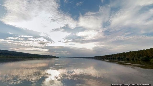
    Traseul Via Transilvanica porneşte din Bucovina,
    de la Putna, străbate Transilvania şi se încheie la Drobeta-Turnu Severin, pe
    malul Dunării, iar o primă vizitare poate fi făcută şi pe Google Street View.

  • The road that unites

    The road that unites

    Street View is a popular service provided by Google Maps, available in more than 85 countries, including the Arctic and Antarctica. In Street View, people can see 360° images from many places around the world. The service is also available in Google Earth and in the Google Maps app for mobile phones. The Street View service has been available in Romania since 2010, when the first images from the most important cities were published on Google Maps. Nationwide Street View coverage was achieved in 2012, when images were taken from 40,000 km of roads, 39 cities and hundreds of tourist attractions. But if this whole story seems history by now, we can tell you that from this autumn Via Transilvanica, the Romanian El Camino, can also be visited on Street View for a trial period, a road that unites.


    Elisabeta Moraru, a Country Manager of Google Romania, told us the story of choosing this route for exploration: We are here because Street View exists. There are places that you can see here and then go visit: the Bruckenthal National Museum in Sibiu is there, Bran Castle, Alba Iulia Citadel, these are emblematic places for us and for the tourism we hope to generate. Street View also means innovation for us. There are few places in Europe where we have images from the underground, and this year we have had the joy of doing an event in the Turda Saltmine. We attended the launch of the images from the Danube Delta, we had the honor of doing the launch right from Mr. Patzaichin’s location and we were not allowed to enter by car, because it is a Nature Reserve and we innovated, we used the cart, that’s why it’s called ‘Cart View.


    To take the panoramic images on Via Transilvanica, they used a tricycle dedicated to such projects, of the recumbent bike type, equipped with an installation on which the panoramic camera is mounted. The whole shooting process lasted about a month and unfolded between August and September 2023.


    The head of the European Commission’s Representation in Bucharest, Ramona Chiriac, praised the project for the awards it won and not only: Early this summer, we promoted two projects from Romania: Via Transilvanica and Călăuzele apelor (Pathfinders of the Waters). They were included on the list of 30 projects from 91 countries that won the prize for Cultural Heritage. These awards have been granted since 2002, they are a project of the European Union, through Europa Nostra and through which we aim to identify and promote the best practices for the preservation of the cultural heritage. And an even greater piece of news was that Via Transilvanica has recently won the EU Public Choice Award, this means that 27 thousand European citizens voted for this project which was in competition with another 29. Congratulations to the people from Tășuleasa Social, for all these distinctions, for the work and passion they show, as well as for the promotion of this Romanian El Camino.


    Alin Uşeriu, from Tășuleasa Social, told us the following: I’m very glad to be here! I lived in Germany for over ten years and, I hope things have changed in the meantime, but all the time I lived there I did not see any positive article or show about Romania. And I set out to do something about it. This is how Tășuleasa Social was born. 18 years have passed, and I think we have reached the second very important milestone: namely to make a project in Romanian society that is not based on fears, on catastrophes. We had some unforeseen funds and we took andesite milestones and marked the Via Transilvanica and it came like a Tsunami over us and in four and a half years we managed to lay 400 tons of andesite milestones.


    Next, work must be done on preserving and expanding a national infrastructure. Because it is a project offered to Romania, as Alin Uşeriu said, and he invited his brother, Tibi Uşeriu, to express his joy for the growth of the project: I would like to go back in time, say five years ago. I remember very well where we were with this route: we were on a path, we were trying to push the weeds aside and we were wondering if we should take this way or that way. And I see today that there are people talking about this project, also the people from Street View, and this is impressive: its amazing to see things in perspective, where we were five years ago and where we are today! I’m happy about this Google Street View initiative because technology is moving forward and I think it’s a great invitation for those who are not very keen on walking, but know a lot about the technical side, and they can see on Street View how cool it is in the digital world, and then say ‘I would like to go see what it looks like in reality! I think it is an extraordinary invitation and will certainly add value to this project!


    Ana Pădurariu, with the Google team, has given us details about this hike of hikes: What we did beyond communicating about Romania on Google Street View, was to communicate about Romania with all our colleagues from around the world. This summer we began photographing the route, we actually have 900 kilometers of the over 1,400 kilometers of Via Transilvanica, which we put on Street View. Maybe you are wondering how we chose what to photograph and here I will tell you that the people from Tășuleasa Social guided us, so that we could cover the seven regions into which the route is divided: Bucovina, Ţinutul de Sus (Upper Lands), Terra Siculorum (towards Sovata), Terra Saxonia (in Copșa Mică), Terra Dacia, Terra Banatica and Terra Romana.


    The Via Transilvanica route starts from Bucovina, from Putna, crosses Transylvania and ends in Drobeta-Turnu Severin, on the banks of the Danube River, and a first tour of Via Transilvanica can also be made on Google Street View. (LS)

  • În Delta Dunării cu Google Street View

    În Delta Dunării cu Google Street View

    Astăzi vă propunem un periplu
    adaptat la realităţile zilelor acestora: un periplu virtual în Delta Dunării,
    un paradis natural, din partea estică a României, situat la vărsarea Dunării în
    Marea Neagră, acolo unde fluviul îşi încheie lungul drum de 2.860 km de la
    izvorul său din Munţii Pădurea Neagră din Germania.


    Delta Dunării
    este încă din 1991 pe harta UNESCO, ca arie protejată. Şi încă din anul 2018
    Delta Dunării devenea obiectiv ce putea fi vizitat şi cu Google Street View,
    graţie entuziasmului unei echipe create de Google România. Filmările au fost
    realizate cu un Tracker. Trackerul este
    un echipament al Google, în versiunea lui mobilă, o cameră în sistem portabil,
    în rucsac şi un suport care trebuie adaptat la vehiculul de folosit, cântăreşte
    puţin peste 20 de kilograme, are 15 camere, care sunt orientate în diferite
    direcţii, astfel încât să facă imagini de 360 de grade, iar imaginile se iau la fiecare 2 secunde şi
    jumătate.

    În deltă trackerul a fost purtat în spate, în căruţă, pe cal sau în
    barcă pe canalele deltei, după cum am aflat la lansarea aplicaţiei chiar de la Cristian
    Mititelu Răileanu, cel care a cărat trackerul prin Deltă, omul căruia îi
    datorăm imaginile:

    Poate că, dacă adunaţi toate canalele şi
    tot ce se vede cu albastru pe Street View nu par să fie chiar 1500 de
    kilometri, dar eu vă spun că am făcut chiar mai mult, pentru că unele drumuri
    le-am făcut de două-trei ori, pentru a acoperi anumite zone.

    Imaginile
    au fost excelente şi culorile frumoase şi pot spune că a ieşit aşa cum am vrut.
    Unul dintre cele mai faine momente a fost când am intrat pe un canal şi după cu
    cot vedeam o grămadă de pelicani sau de cormorani şi mă gândeam că imaginile
    astea vor fi pe Google.

    Sunt anumite ipostaze ale Deltei care nu apar tot
    timpul şi atunci când mergi pe un canal poţi să nu vezi niciunul sau să ai surpRize
    foarte mari, să dai de sute de pelicani, de exemplu, pe un lac sau pe un canal.
    Astea au fost momentele când mă întrebam cum vor arăta imaginile pe Street
    View.


    Un explorator virtual poate admira pelicanii care își iau zborul de pe
    Canalul Trofilca, un canal mic, care șerpuiește printr-o pădure inundată,
    mlaștini și lacuri. Mai apoi poate se poate plimba pe canalul Șontea, pe sub
    vița de vie sălbatică și pe sub sălciile care atârnă deasupra canalului
    Rădăcinos, creând un tunel de vegetație spectaculos.

    La câteva click-uri
    distanţă peisajul se schimbă: un lac cu nuferi, stârci, egrete și pelicani.
    Iubitorul de păsări poate vedea cormoranii care se hrănesc pe Lacul Puiu sau
    poate da o fugă pe laguna Sacalin, aflată la vărsarea Dunării în Marea
    Neagră, la capătul celui mai sudic braţ, Sf. Gheorghe.

    Pe uscat, poate explora arhitectura tradițională din Deltă, în localitatea
    Letea, sau se poate plimba pe uliţele din localitatea Mila 23. La final, se poate relaxa pe plaja
    sălbatică din Sf. Gheorghe sau poate avea o vedere
    panoramică din vârful unui vechi far din Sulina.


    Delta Dunării,
    lăsând la o parte că este o destinaţie naturală şi antropică de top, pentru că
    aici avem şi multe comunităţi şi lipoveneşti şi ucrainene şi româneşti, avem
    peisajele naturale unice şi o mare diversitate a faunei şi florei, Celor de la
    Google li s-au alăturat şi cei de la WWF România.

    Camelia Ionescu, responsabil
    proiecte, ne-a explicat:

    Avem peste 30 de
    ecosisteme, peste 10 mii de specii identificate în Deltă, multe dintre ele
    protejate, putem să vorbim despre Deltă ca o zonă în care găsim cea mai întinsă
    zonă compactă de stuf din lume. Noi,
    fiind o organizaţie de conservare, avem în vedere şi faptul că în Deltă au
    trăit şi trăiesc oameni şi este important că acei oameni au venit cu o cultură
    unică.

    Oamenii au utilizat resursele naturale, s-au inspirat şi artistic din
    natură, au împodobit habitatele lor cu peşti, cu sturioni, iar stuful este
    reprezentat şi pe casele oamenilor. Delta vine şi cu o valoare economică,
    stuful poate fi folosit ca resursă şi resursa piscicolă, care este o atracţie
    importantă pentru turism: oamenii vin să vadă, să pescuiască, dar şi să guste
    borşul de peşte autentic făcut în Deltă.


    Prin această tehnologie, orice om de pe planetă, care are acces la internet
    ar putea să acceseze din orice colţ al lumii, Delta Dunării.

  • Mit „Horse View“ durchs Donaudelta

    Mit „Horse View“ durchs Donaudelta

    Ein virtueller Entdeckungsreisender hat nun die Möglichkeit, die auf- und abfliegenden Pelikane im Kanal Trofilca zu beobachten. Trofilca ist ein kleiner Kanal, der sich durch einen überfluteten Wald und entlang von Sümpfen und Seen schlängelt. Der virtuelle Besucher kann weiter über den Kanal Şontea fahren. Oder zwischen wilden Weinreben und unter hinunterhängenden Weiden spazieren, die entlang des Kanals Rădăcinos einen spektakulären Pflanzentunnel bilden. Einige Klicks weiter nimmt die Landschaft eine völlig andere Form: Ein von Seerosen bedeckter See, Reiher und Pelikane können betrachtet werden. Vogelliebhaber können Kormorane auf dem See Puiu beobachten oder die Lagune Sacalin erkunden. Auf dem Land können virtuelle Besucher die traditionelle Architektur im Donaudelta im Dorf Letea erforschen. Oder sie können einen Spaziergang durch die schmalen Stra‎ßen in der Ortschaft Mila 23 machen. Zum Schluss können sie sich am wilden Strand in Sankt Georg entspannen oder in den alten Leuchtturm in Sulina steigen und von dort die Aussicht genie‎ßen. All das, weil seit weniger Zeit das Donaudelta auch in Street View zur Verfügung steht.


    Das Projekt entwickelte sich nur mühsam. Die Vertreter von Google Rumänien dachten 2012, das Vorhaben könne nicht weiter als Cernavodă fortgesetzt werden. Street View ermöglichte, die Donau virtuell von Bratislava nach Cernavodă zu befahren. Letztes Jahr fand man allerdings die Möglichkeit, auch das Donaudelta zu erkunden, sagte uns Gabriela Chiorean, Kommunikations-Expertin bei Google:


    An den Orten, die wir zu Fu‎ß nicht erreichen konnten, verwendeten wir ein Horse View. Der Tracker wurde schon vielseitig eingesetzt — auf Inseln, mit Hilfe von Schafen oder in der Wüste, mit Hilfe von Kamelen. Jedoch haben wir bislang niemals diesen Horse View eingesetzt, also Bilder, die von einer Pferdekutsche aus geschossen wurden. Wir haben mehr als 1500 Km abgedeckt. Wir haben uns durch Kanäle geschlängelt und sind über die Landeswege im Karren gefahren. Der Tracker wiegt etwa 20 Kg. Er ist aus 15 Kameras gebildet, die in verschiedenen Richtungen ausgerichtet sind, so dass die Kamera 360 Grad Bilder aufnehmen kann. Die Bilder werden alle 2,5 Sekunden geschossen.“


    Camelia Ionescu ist zuständig für die von WWF in Rumänien umgesetzten Projekte. Sie erzählte uns über die Zusammenarbeit von WWF mit Google Rumänien:


    Ich möchte Ihnen erklären, weshalb wir, eine Organisation, die sich für den Naturschutz einsetzt, entschieden haben, dieses Projekt zu unterstützen. Im Donaudelta gibt es mehr als 30 Ökosysteme und über 10.000 Tier- und Pflanzenarten. Viele davon stehen unter Naturschutz. Darüber hinaus gibt es im Donaudelta das breiteste kompakte Schilfgebiet weltweit. Unser Hauptanliegen ist die Konservierung der Natur. Land und Leute sind wichtig. Wir dürfen nicht vergessen, dass im Donaudelta auch Menschen leben. Und ihre Kultur ist einmalig. Die Menschen haben die natürlichen Ressourcen vor Ort verwendet, sie haben in der Natur und in ihrer Umgebung sogar künstlerische Inspiration gefunden, haben ihren Lebensraum mit Fischen, mit Stören geschmückt. Schilf kommt auch oft auf den Wänden der Häuser als künstlerische Repräsentation vor. Das Donaudelta setzt auch einen wirtschaftlichen Mehrwert voraus: Schilf kann als Baustoff eingesetzt werden. Darüber hinaus kommen viele Touristen zum Fischen ins Donaudelta. Oder einfach, um die von den Ortsbewohnern gekochte Fischsuppe zu probieren. Wir glauben, dass diese neue Technologie, die Möglichkeit, auf das Donaudelta von überall in dieser Welt zuzugreifen, ein gro‎ßer Vorteil ist. Somit findet das Donaudelta einfacher einen Platz in den Herzen der Menschen. Und ich hoffe, die Menschen werden somit umweltbewusster und bereiter, die Natur und damit auch das Donaudelta, zu schützen.“


    Cristian Mititelu Răileanu hat den Tracker überall durch das Donaudelta geschleppt. Ihm verdanken wir die Bilder, die wir heute sehen. Er erzählte uns mehr über seine Erfahrung im Donaudelta:


    Wenn Sie alle Kanäle und sämtliche blauen Linien, die sie im Street View sehen, addieren, weicht das Ergebnis vermutlich von den abgezielten 1500 Km ab. Doch ich kann Ihnen versichern, dass wir sogar mehr Kilometer zurückgelegt haben. Manche Strecken haben wir zwei-, dreimal wiederholt, um gewisse Gebiete komplett abzudecken. Der Tracker ist eine Ausstattung von Google. Es ist ein mobiles Gerät, eine tragbare Kamera. Ich trug sie in meinem Rucksack. Au‎ßerdem brauchten wir eine Einrichtung zum Befestigen des Trackers, die je nach Fahrzeug angepasst wurde. Auf dem Boot zum Beispiel musste ich eine hölzerne Einrichtung selber bauen und sie an dem Boot befestigen. Denn das Boot bewegt sich anders als ein Auto. Doch Ende gut, alles gut. Bis zum Schluss hat alles bestens geklappt, die aufgenommenen Bilder haben eine gute Qualität. Während der Fahrt dachte ich ständig, dass die schönen Bilder, die sich uns zeigten, die Pelikane und Kormorane, die wir auf einem See überraschten, in Kürze auf Google gesehen werden könnten. Das freute mich überaus. Im Donaudelta findet immer wieder etwas Unwiederholbares statt. Das waren die Augenblicke, die mir Freude bereiteten und ich fragte mich, wie sie in Street View zu sehen sein werden.“


    Der Nutzen des Projekts ist klar. Elisabeta Moraru, Country Business Development Manager bei Google Rumänien, versuchte dennoch eine knappe Zusammenfassung als blo‎ße Übung der Vorstellungskraft:


    Es ist 8.15 Uhr morgens, an irgend einem Tag in Oktober. Die Kinder treten in den Klassenraum in ihrer Schule in der Ortschaft Vişeul de Sus [dt. Oberwischau im Kreis Marmarosch] ein. Der Lehrer sagt ihnen: ‚Holt eure Handys heraus, heute werden wir über das Donaudelta lernen.‘“

  • По Дунаю з Google Street View

    По Дунаю з Google Street View

    Шість країн, три столиці, фортеці, ущелини й тисячі вражаючих пейзажів. Таким є запрошення від Google до подорожі по Дунаю від Братислави до Чернаводи, зроблене через опублікування на Google Maps зображень Street View (“Перегляд вулиць“) з найбільш представницького водного потоку Європи. Фахівці Google плавали і фотографували по Дунаю влітку 2014 року, зібравши зобрaження зі Словаччини, Хорватії, Сербії, Угорщини, Болгарії і Румунії, а потім опублікували їх у Street View. Таким чином було досліджено дві третини Дунаю.


    Ми звернулися до Дана Булучі, кантрі-менеджера Google, з проханням розповісти про запуск цієї нової служби: “Для нас це був важливий момент. Це перший запуск Street view, який охоплює шість країн: йдеться про круїз по Дунаю, дійсно, віртуальний, але не менш важливий, починаючи від кордону Австрії зі Словаччиною через такі країни як Хорватія, Угорщина, Сербія, Румунія й Болгарія, досягаючи до Чернаводи. На даний момент будь-який користувач Інтернету може побачити столицю Угорщини, столицю Сербії, Казанеле Марь (укр. “Великі казани) у Румунії чи міст в Чернаводі. У першу чергу, можна побачити, не піднімаючись зі стільця й сидячи перед компютером, як виглядають ті зони, ми можемо сформувати своє перше враження. Особисто я ніколи не повірю, що це усуне емоцію фізичної присутності в тих місцях, але це допомагає нам зрозуміти, як виглядає дане сусідство. В тій же мірі ми можемо детальніше побачити певні речі, можемо знайти нову перспективу тому, що означає круїз по Дунаю, можемо сформувати власну думку щодо зон, які вартує відвідати в першу чергу і, чому ні, це може надихнути нас на майбутні екскурсії та відпустки“.


    Це досягнення є особливим і через той факт, що робить настільки доступним подібний круїз. Вірніше, Street View дозволяє, в основному, розглянути те чи інше місце з кількох сотень країн світу, як розповів нам наш співрозмовник, після чого поділився, як робляться ці зйомки: “Йдеться про запис спеціальною камерою: на платформі є 15 камер, які здійснюють панорамне зображення, на 360 градусів, і створюють у нас відчуття, що ми можемо дивитися довкола, де б ми не знаходилися. Street view tracker, – тому що саме це платформа, з якою було зроблено і подорож по Дунаю, – можна покласти в рюкзак, комусь за спину таким чином, що вона може потрапити в такі місця, які не доступні, наприклад, машині. Ми постійно стараємося актуалізувати всі зображення. Зокрема, для цього запуску Дунаю зображення були зняті минулого року, і ми постійно намагаємося актуалізувати їх. Через певні причини як несприятлива погода, деякі зображення є невідповідними, і тоді ми не можемо їх опублікувати. Але в поєднанні з картою високої точності, в поєднанні з інформацією про транспортний рух, наприклад, Street view доповнює наш віртуальний досвід в тому сенсі, що в часи, коли нам була достатня друкована карта, зараз ми маємо набагато більше претензій: ми хочемо знати, де знаходимося, можливо, ми захочемо знати, де перебувають наші друзі, і разом ми захочемо знайти підходяще місце, де б можна було зустрітися й випити разом каву“.


    Якщо ми вже звикли вибирати маршрут по місту, щоб потрапити за найкоротший час у певне місце, з урахуванням транспортного руху та інших несприятливих факторів як роботи по поліпшенню доріг, використання Street View для подорожі по Дунаю, звичайно ж, стосується не швидкості чи рейсу, який ми оберемо, а скоріше краси пейзажів, якими ми можемо насолодитися. Існує відбір місць та вражаючих моментів на Дунаю, захоплених камерами Google, як статуя дакського короля Децебала в регіоні Казанеле Марь чи схід сонця під мостом у Чернаводі.


    З подробицями Дан Булуча: “Я народився в тій зоні південно-західної Румунії, й це такі гарні місця. Звичайно, коли я отримав зображення, то перше, що я зробив, – я подався туди, пробуючи знову побачити місто Оршова, Казани, місця, які особисто мені пробуджують надзвичайні емоції. На цьому маршруті є три важливі столиці: Братислава, Будапешт, Белград, які, на мою думку, вартує побачити і з судна, що знаходиться на річці. Ще я додав би Залізні ворота, мости Джурджіу-Русе, Чернаводе і, гадаю, що й шанс побачити схід сонця із судна в круїзі по Дунаю має свою чарівність“.


    І так як цього року відзначилося 10 років Google Maps, Дан Булуча розповів нам про тісний звязок, який має Google із своїми користувачами з Румунії: “Колись ми орієнтувалися за простою надрукованою картою, яка вже після свого опублікування була застарілою. Зараз за допомогою цифрових карт ми маємо претензії, щоб вони були повними, якомога точнішими, щоб були інтерактивними, персоналізованими; ми хочемо знати, де є парки, хочемо знати, де можемо знайти певні кавярні чи різні послуги. Карта повинна адаптуватися до наших потреб. І це певним чином досягнено. За ці 10 років Google Maps став продуктом, яким користуються понад мільярд людей щомісяця у всьому світі. Є понад 200 країн, які мають карту Google Maps. Окрім цієї точності, вражаючим і своєрідним для Румунії є те, як відповідають користувачі на карти: переважна їхня більшість актуалізована користувачами. В Румунії є дуже активна громада таких користувачів, які мають в розпорядженні необхідні інструменти, і хто знає краще них, як йдуть справи в певному сусідстві. Ми маємо можливість постійно актуалізовувати, тому що світ перебуває в постійній зміні, і якщо ми хочемо мати повну й точну карту, вона теж повинна змінюватися“.


    А нам не залишається нічого іншого, як запросити вас до круїзу по Дунаю, спочатку віртуального, а потім, чому ні, реального, де ви зможете випробувати точність зображень, якими вас спокусив Google Street View.